Solutions
Overview
We at D’AVIATORS work closely to understand the need of the hour and develop the best solution to overcome the problem. Our team of researchers and innovators, creates solutions to enhance the capabilities of existing set-up to perform more efficiently and build intelligent drones for a smart planet.
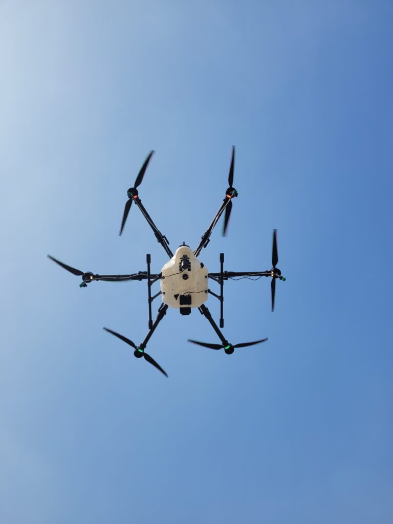
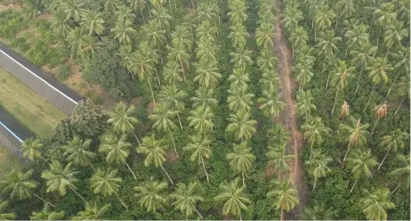
Agriculture
Precision agriculture is a farming management concept based on observing, measuring, and responding to inter & intra-field variability in crops. The farmer’s and/or researcher’s ability to locate a precise position in a field lets him create maps of the spatial variability of as many variables as can be measured (e.g. crop yield, terrain features/topography, organic matter content, moisture levels, nitrogen levels, pH, etc.)
Precision agriculture has been enabled by technologies like: crop yield monitors mounted on GPS-equipped combines; variable rate technology (VRT) like seeders, sprayers, etc,; an array of real-time vehicle mountable sensors that measure everything from chlorophyll levels to plant water status; and multi- and hyper-spectral aerial and satellite imagery, from which products like Normalized Difference Vegetation Index (NDVI) maps are made.
The KISAAN UAV configuration includes a versatile payload system that allows for the switching between a 16-litre liquid tank and a 10-kilogram seeder tank, enabling multiple applications. The process of switching payloads can be completed within 10 minutes. Additionally, the UAV is equipped with a 12 MP 4K RGB camera that provides live-feed and captures high-resolution videos and images for analysis.
Surveillance & Monitoring
Our UAVs are ready whether you’re monitoring a large event, a protest, or even an individual, our aerial vehicles can provide your team with the overview they need to maintain control. Our UAV monitoring systems provide a number of benefits to users focused on public safety and civil security: long flight times mean fewer pauses for battery changes and more monitoring. Real-time monitoring and coordination, Tough in rough weather & Payload flexibility.
Delivering redundant UAVs with best-in-class cameras having various customizations as per requirement.
The AGNYA UAV setup possesses the ability to ascend to an altitude of 300 meters above ground level (AGL) while offering a flight duration of over 50 minutes. It is also designed to withstand wind speeds of up to 30 knots. The payload of the UAV includes a Day and Night Vision RGB Camera equipped with a 36x optical zoom feature, along with a 3-axis gimbal to ensure stable footage capture.
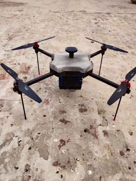
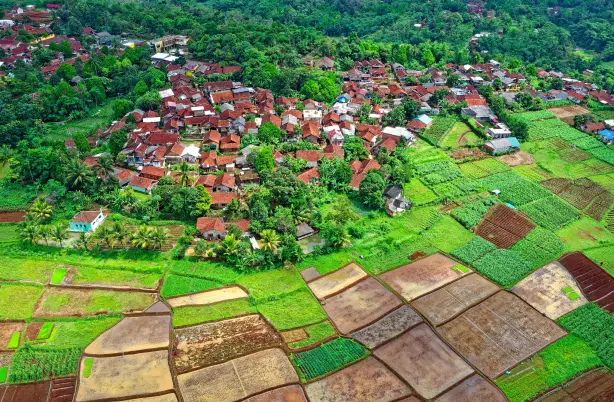
Survey & Mapping
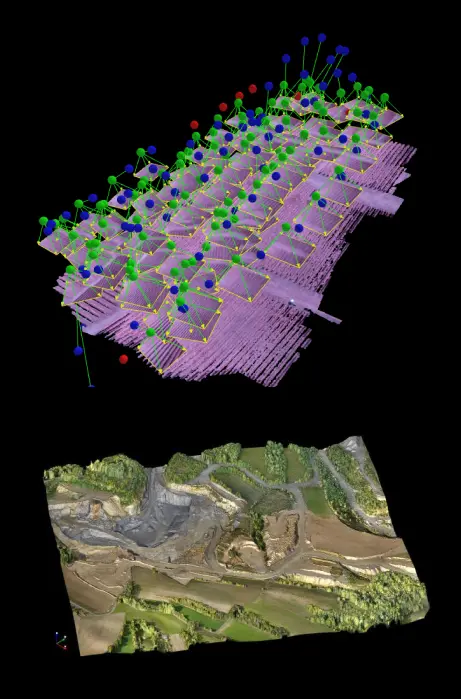
The process of mapping using drones involves employing a technique known as photogrammetry, which involves making measurements from photographs. This technique enables the creation of a 3D model of a real-world object or scene. Drones equipped with ultra-high-resolution optical sensors are deployed to capture multiple overlapping photos of the ground, following a predetermined flight path.
Our indigenous DRISHTI UAV model incorporates state-of-the-art technology and features, along with a redundant structure designed to withstand harsh environments and deliver precise results. The redundant structure of the DRISHTI UAV is constructed using carbon fiber and nylon-reinforced plastic, making it both durable and lightweight, thus optimizing its performance. The UAV’s powerful propulsion system allows it to ascend to a height of up to 120 meters above ground level (AGL), while its lightweight structure enables a flight time of up to 60 minutes.
Agriculture
Our flying platforms offer continuous and real-time aerial monitoring, allowing persistent data collection and analysis.
Drones in agriculture:
- Spraying – Fertilizer, Herbicide, Fungicide, Pesticide
- Seeding – Seeds, Desiccants
- Use of drones to gather data for precision agriculture – Remote sensing technology plays a critical role in this process by detecting radiation emitted from the ground and providing information on various physical characteristics. Advanced agriculture mapping drones utilize multispectral imaging to enhance this concept.
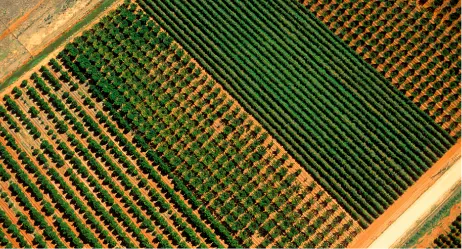
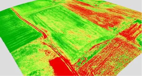
- RGB Maps – Even a rudimentary Red Green Blue (RGB) map provides valuable information, offering a bird’s-eye view that can be even more useful. Such maps enable precise measurement of the available land for cultivation down to the centimeter and facilitate long-term crop monitoring, helping farmers make adjustments from one season to the next.
- NDVI Maps – The Normalized Difference Vegetation Index (NDVI) enhances the insights provided by an RGB map by measuring the amount of infrared light reflected in an area, which can be an indicator of malnourishment and drought. This type of data collection can detect problem crops up to two weeks before physical signs appear, according to Go Intelligence. This makes NDVI an invaluable tool for farmers looking to accurately predict their yield rate.
- Field monitoring and crop scouting – Drones offer imagery at an exceptionally high resolution and are less susceptible to cloud interference compared to satellite imagery. This feature allows drones to accurately identify pests, diseases, weeds, evaluate crop emergence, and other issues in the field. Additionally, drones can be equipped with various sensors and cameras, including RGB and multispectral cameras, that can calculate vegetation indices like NDVI, MSAVI, and NDRE.
Benefits of modern agricultural drones :-
Enhance the effectiveness of managing extensive mining locations and quarries by promptly delivering comprehensive data on their condition. Workers on site can securely produce this data without the need to climb over heaps of materials or navigate through active construction equipment, thereby avoiding potential hazards. Moreover, this can be achieved at a significantly lower expense than conventional surveying methods, and without interrupting machinery operations.
- Improved Productivity: Agricultural drones’ capability to satisfy the challenges of enormous economies is one of the most thrilling advantages.
- Adaptation to Climate Change: For many agricultural activities, severe weather has become an unspoken reality. Farm-workers are working cooperatively towards development by using drone techniques.
- Reducing Pollution: Drones engender valuable facts by monitoring plant growth and identifying disturbed and pollutant areas.
- Increase Yields: Agricultural drones generate data that producers can use to minimize pesticide usage by monitoring plants’ growth and locating disturbed areas.
- Save Time: Drones with this degree of specificity will help farmers increase supply and cost savings. It will result in increased outcomes with less time.
- Cost-effective: Using drones for crop monitoring and mapping is generally more cost-effective than hiring a manned aircraft or relying on satellite imagery.
- Safety: Drones can be used to inspect and monitor crops and land in areas that are difficult or unsafe to access manually, reducing the risk of injury to workers.
- Return on Investment: One of the most significant benefits of drones in agriculture is their capability to explore farm regions reliably. Drones will typically pay for themselves in growing seasons or less. It will leave you with a drone that lowers your operating expenses.
- Ease of Use: UAV systems are not difficult to implement and run. Thus, with pre-set requirements, tech startups can feel confident in their abilities.
- Integrated GIS Mapping: This mapping holds the key to enhancing productivity, lowering prices, and propelling the company forward. It shows which parts of the crop have to be looked at more precisely.
- Crop Health Imaging: Drone invention is proven to be very successful at gathering data to support landowners to improve crop performance. You will see how much sunlight had consumed by the growing season. You can examine this by looking at the actual health of your crops.
- Failsafe Drone: Your Accurate Drone will back to its original launch position with the push of a button as an additional support system.
- Water Efficiency: Agricultural cameras can distinguish between colder, well-watered land areas and bare hot spots. Farmers may use this information to change field drainage and save water.
- Environmental Benefits: Precision agriculture facilitated by drones can reduce the use of fertilizers, pesticides, and other chemicals, thus lowering their environmental impact.
Surveillance
D’AVIATORS suggests using the Airborne Security solution for Surveillance and Security Applications, which includes both thermal and optical zoom sensors.
This solution is especially effective in populated areas, as the drone can safely return home in the event of a major system failure. The Airborne Security solution is a comprehensive security and surveillance drone that meets all requirements.
Our company specializes in designing, manufacturing, and promoting long-range UAVs for industrial-strength commercial use. Our long-range UAVs can fly for up to 60 minutes and carry payloads of up to 5kgs, providing significant advantages for businesses and commerce. We can also create customized solutions to meet the specific needs of our clients, and our services include support and training during and after implementation.
What our drones can do to help?
To manage, influence, direct, or protect a person, group of people, behaviors, activities, infrastructure, building, or similar things, surveillance is the process of closely observing them. GPS tracking, camera observation, stake-outs, data mining, profiling, and biometric surveillance are various surveillance methods. Stationary cameras usually limit traditional observational surveillance, requiring manual handling or fixing on a tripod or other structure. Aerial surveillance via helicopters is effective but expensive.
Drone surveillance provides an optimal solution to the problems and constraints encountered by other surveillance methods. Collecting data through drones is faster, easier, and more affordable. Drones can enter narrow and confined spaces, emit low noise, and have night-vision cameras and thermal sensors, providing imagery that the human eye cannot see. They can also cover large and inaccessible areas, reducing staff numbers and costs, and do not require much space for their operators.
Drone applications in specific industries
Tactical, Oil and Gas, Perimeter, Maritime, Event Security, Solar Farms, Traffic Management, Swat, Anti-Poaching
In the past, detecting and locating leaks in oil and gas fields has been both expensive and ineffective, as workers have had to climb tall structures and inspections have caused significant delays in operations. However, drones provide a safe and cost-efficient solution to these challenges.
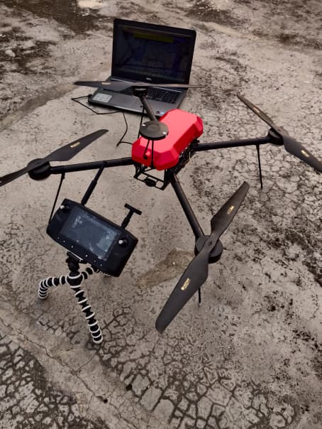
Survey
D’AVIATORS suggests using the Airborne Security solution for Surveillance and Security Applications, which includes both thermal and optical zoom sensors.
What is drone survey?
Drone survey, also known as aerial survey or unmanned aerial vehicle (UAV) survey, is a method of collecting geospatial data using unmanned aerial vehicles or drones equipped with high-resolution cameras, Lidar or other sensors.
The drones are flown over a designated area and capture high-resolution images, which are then processed using specialised software to create accurate, detailed maps and models of the terrain, buildings, or infrastructure. Drone surveys are commonly used in a variety of fields such as construction, agriculture, mining, environmental monitoring, and urban planning.
Drone applications in specific industries
Surveying and GIS
Drone technology has immense potential for surveyors and GIS professionals as it significantly reduces the expenses and time required for data collection. In addition, it enables the survey of previously inaccessible regions and the production of high-quality aerial maps with a level of detail that would otherwise be unfeasible due to safety or cost concerns.
- Land surveying
- Cadastral maps
- Topographical surveys
- Precise measurements
- Land management and development
- Urban planning
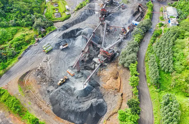
Mining and Aggregates
Enhance the effectiveness of managing extensive mining locations and quarries by promptly delivering comprehensive data on their condition. Workers on site can securely produce this data without the need to climb over heaps of materials or navigate through active construction equipment, thereby avoiding potential hazards. Moreover, this can be achieved at a significantly lower expense than conventional surveying methods, and without interrupting machinery operations.
- Inventory and management of stockpile volume
- Mine or quarry monitoring and operation planning
- Assessment before drilling or blasting
- Road monitoring
- Slope monitoring
- Hazard identifications
Construction and Infrastructure
DRISHTI UAV assists construction experts in efficiently drone-mapping extensive or inaccessible regions for pre-construction assessment. This results in reduced expenses and faster turnaround times for surveying and construction, while ensuring that the project stays within budget and on schedule.
- Volume measurements
- 3D models of sites
- Tracking construction progress
- Orthomosaic map
- 3D point cloud
- Digital surface models (DSM)
- Digital terrain model (DTM)
- 3D textured mesh
- Contour lines
